The draft London Plan could open up far more of Enfield’s Green Belt for housing and industrial development than most residents realise.
The Mayor of London, Sadiq Khan, is consulting on a new London Plan which will set the rules for how the capital grows over the next 20 years, including where new homes and jobs should go.
For Enfield, his draft London Plan (dLP) sets a target of 7,000 homes on greenfield land by 2036/37 and identifies Crews Hill and Chase Park as the borough’s Green Belt residential growth area.
But the dLP goes far further than that.
An annex at the back of the Plan identifies Green Belt land City Hall considers suitable for major housing and industrial development.
For homes, the main test is whether the “vast majority” would be within a 1,200 metres walking distance of one of the stations listed in the dLP’s annex, or within 400 metres of a “qualifying bus route”.
The dLP lists five train or tube stations located within a broad growth area called ‘Crews Hill and Chase Park’, namely Crews Hill, Gordon Hill, Hadley Wood, Cockfosters and Oakwood.
The same annex also identifies parts of Enfield’s Green Belt for potential industrial development.
The test for new industrial units is different. The dLP treats Green Belt land within 2,500 metres of a suitable major road junction as potentially suitable for industrial growth. In Enfield, this includes Junction 25 of the M25, while the area around Junction 24 is identified for possible future industrial development.
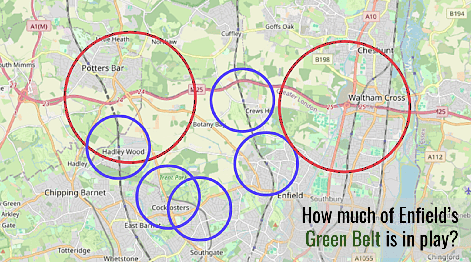
The combined effect of the policies becomes easier to understand when shown on a map. Our map uses blue circles to show a 1,200-metre radius around the five stations (these are only a guide as the dLP uses walking distance, not a straight line). The red circles show 2,500 metres around Junctions 24 and 25 of the M25.
Figure 1: Green Belt areas covered by the dLP housing (blue) and industrial location test (red)
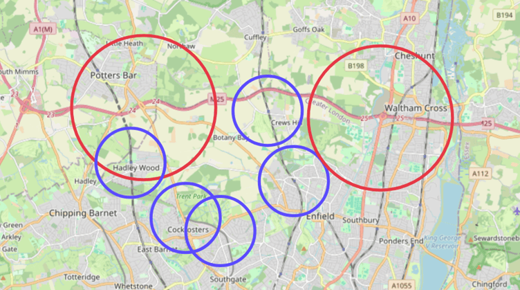
Note: Parts of the circles (especially the red circles) extend beyond Enfield and Greater London into neighbouring Hertfordshire. The Mayor has no power to allocate or release Green Belt land outside Greater London, so the dLP location tests only apply to the London side of the boundary.
The map shows the scale of the areas that fall within the dLP’s housing and industrial location tests, but that is only part of the picture. The map does not include Chase Park, other Green Belt sites already proposed in Enfield’s Local Plan, land that could qualify through the bus route test, or “grey belt” land. If these were added, the area potentially affected would be larger still.
Furthermore, not all housing would need to fall within the blue line – the test is that the “vast majority” does so. That means areas outside the blue lines could also be suitable for development.
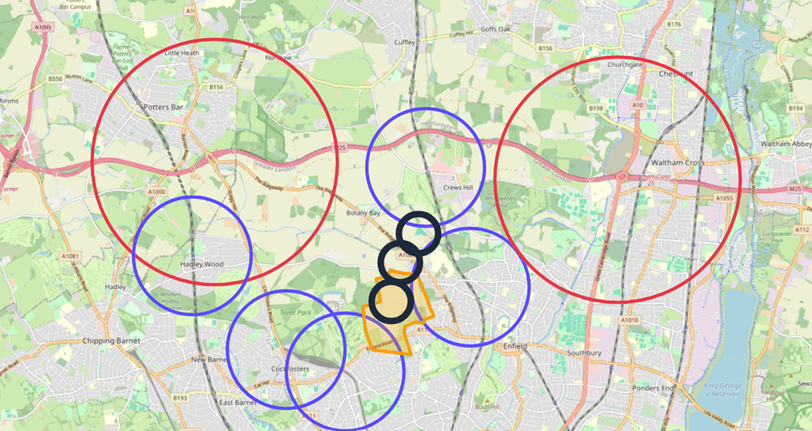
We have created the map below to illustrate how the bus route test could extend the area affected. The black circles show an illustrative 400 metre catchment around a possible future bus route through Chase Park, while the orange outline shows Chase Park itself. No such bus route is identified in the draft London Plan, so this is shown for illustration only. Nor would any ordinary bus route qualify. The draft Plan sets specific standards for qualifying routes, including agreement with TfL.
Figure 2: Map showing approximate overlay of Chase Park and illustrative bus route impact.
The circles on our maps are not allocations, and do not show land which would definitely be built on. Some of the land is already developed, or has wildlife, heritage or other protections. And any planning application would still have to be assessed against other policies.
But the circles do show where major Green Belt development could be located. The dLP says Green Belt release in these areas is “acceptable in principle” and that there are “strategic exceptional circumstances” to justify this.
The full impact of any government decision on a new town at Crews Hill and Chase Park is unknown. But even without a new town, the dLP would create a new strategic framework which could put far more of Enfield’s Green Belt into play for housing and industrial development than most residents are likely to have realised.
To put the scale of the areas involved into context, a single blue circle covers around 452 hectares, more than five times the size of the entire 85-hectare Meridian Water development area.
The tables at the back of the dLP are easy to overlook, but they are not harmless background material. They are a key part of the framework City Hall proposes to use when deciding where major development in the Green Belt may be acceptable, including on greenfield land, whether through changes to Enfield’s future Local Plans or individual planning applications.
Taken together, these policies would fundamentally alter large parts of Enfield’s Green Belt. Land historically protected from major development would instead sit within a strategic framework expressly designed to enable building on it.
If Sadiq Khan’s plan is adopted, it would mark the beginning of the end of Enfield’s Green Belt as residents have known it.
The public consultation on the Draft London Plan is open until 5:00 PM on Thursday, 15 October 2026 and can be accessed here.


One thought on “If Sadiq Khan’s new London Plan is adopted, it would mark the beginning of the end of Enfield’s Green Belt.”
Comments are closed.